More On: 2020 presidential election
Sneaker guru Joe La Puma on Kamala Harris’ Converse moment
Top CEOs met to plan response to Trump’s election denial
Gambling sites refuse to call election for Biden, leaving $600 million in limbo
Twitter labeled 300,000 ‘potentially misleading’ election tweets
How the 2020 presidential election saved fizzled-out Champagne industry
If you look back at presidential electoral maps from the past century, it paints a visual picture of how massive political shifts can occur in relatively short periods of time, even if things often feel set in stone in the present moment. California was a red state until 1992, for example, while Texas went blue …
If you look back at presidential electoral maps from the past century, it paints a visual picture of how massive political shifts can occur in relatively short periods of time, even if things often feel set in stone in the present moment. California was a red state until 1992, for example, while Texas went blue as recently as 1976. Here’s a collection of every Presidential Electoral Map since 1900, many of which are truly unrecognizable today.
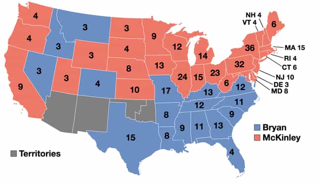
1900: William McKinley vs. William Jennings Bryan
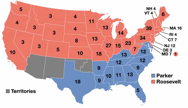
1904: Theodore Roosevelt vs. Alton B. Parker
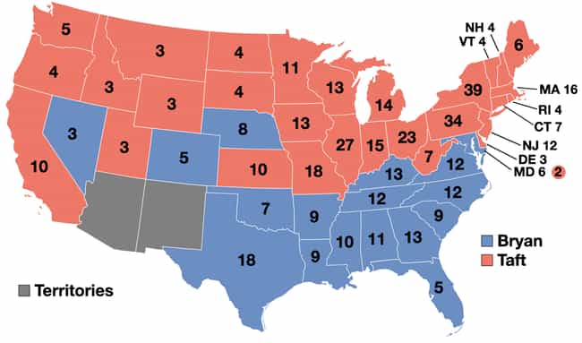
1908: William Howard Taft vs. William Jennings Bryan
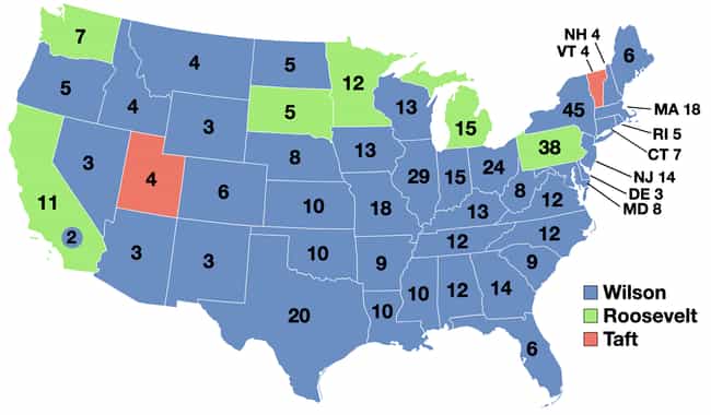
1912: Woodrow Wilson vs. William Howard Taft vs. Theodore Roosevelt
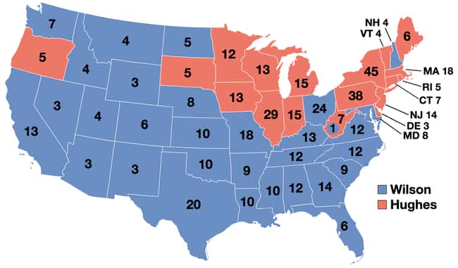
1916: Woodrow Wilson vs. Charles Evans Hughes
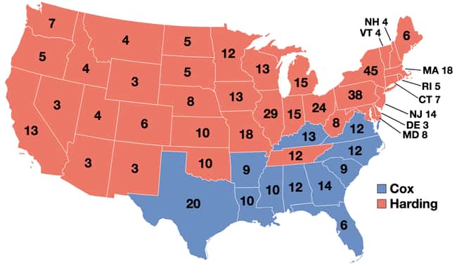
1920: Warren G. Harding vs. James M. Cox
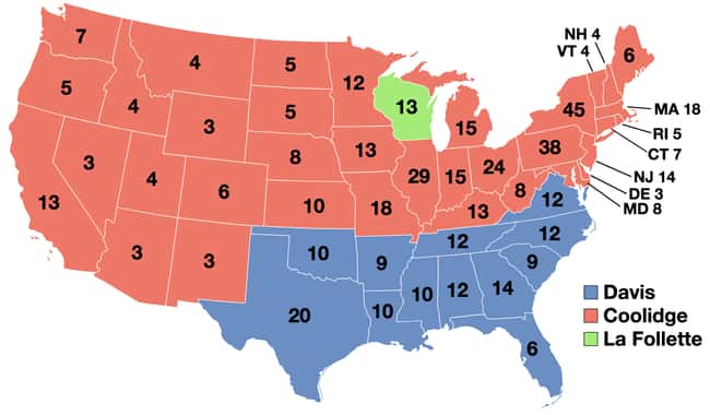
1924: Calvin Coolidge vs. John W. Davis vs. Robert M. La Follette
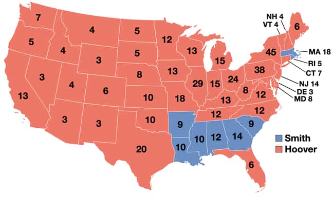
1928: Herbert Hoover vs. Al Smith
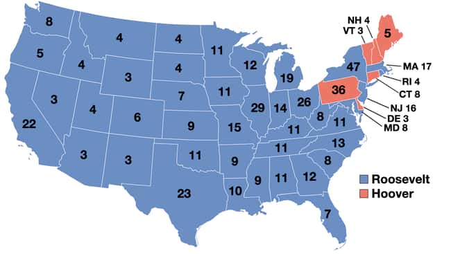
1932: Herbert Hoover vs. Franklin D. Roosevelt
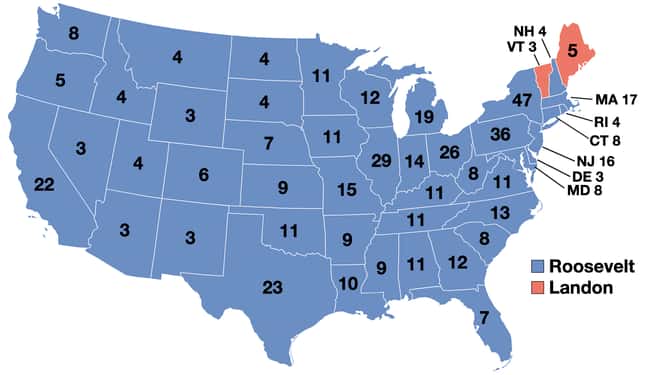
1936: Franklin D. Roosevelt vs. Alf Landon
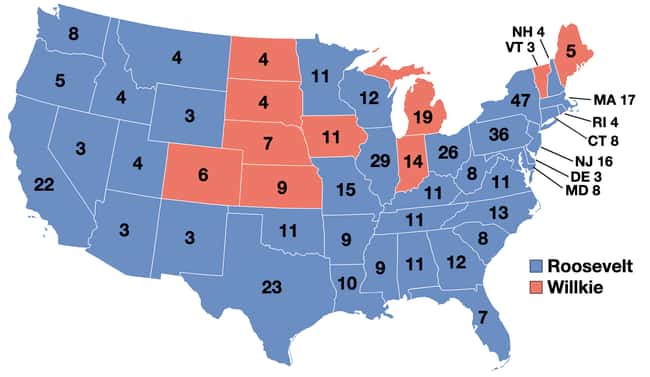
1940: Franklin D. Roosevelt vs. Wendell Willkie
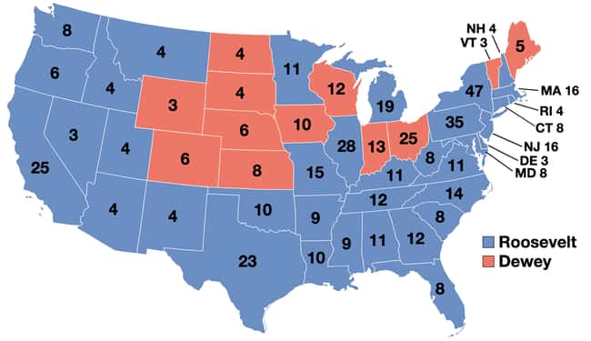
1944: Franklin D. Roosevelt vs. Thomas E. Dewey
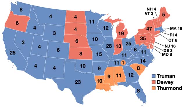
1944: Harry S. Truman vs. Thomas E. Dewey vs. Strom Thurmond
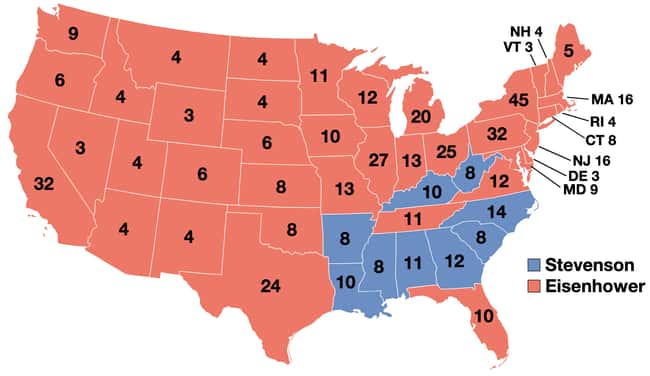
1952: Dwight D. Eisenhower vs. Adlai Stevenson
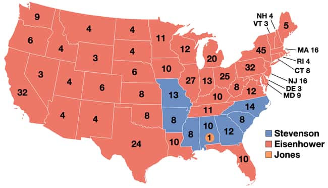
1956: Dwight D. Eisenhower vs. Adlai Stevenson
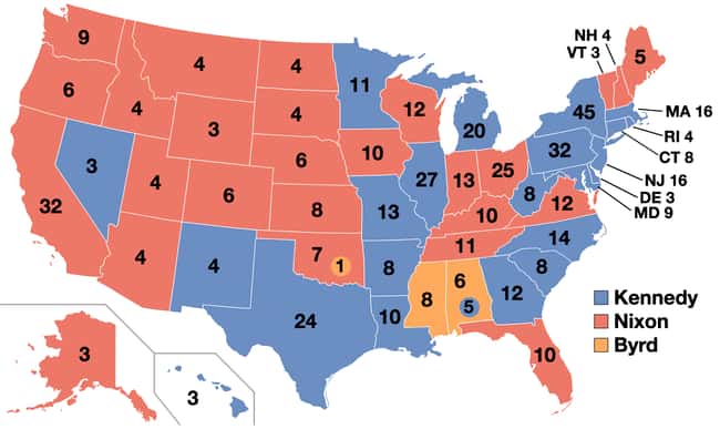
1960: John F. Kennedy vs. Richard Nixon
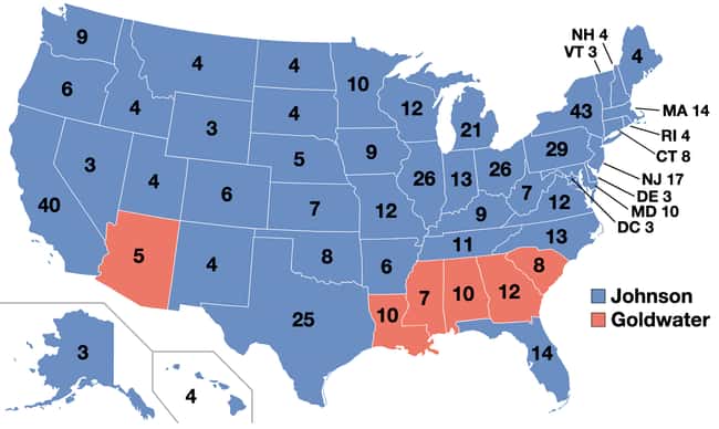
1964: Lyndon B. Johnson vs. Barry Goldwater
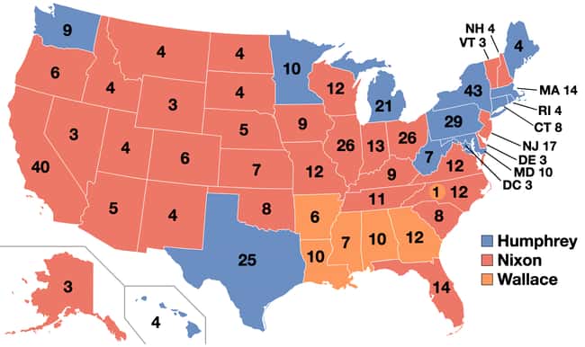
1968: Richard Nixon vs. Hubert Humphrey vs. George Wallace
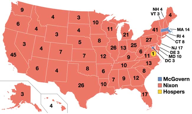
1972: Richard Nixon vs. George McGovern
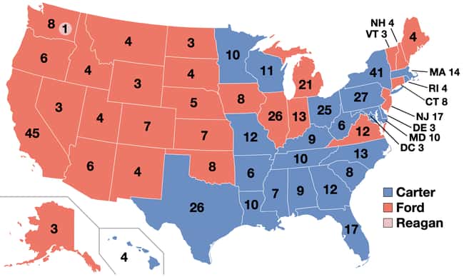
1976: Jimmy Carter vs. Gerald Ford
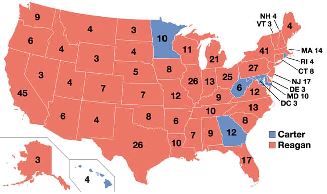
1980: Ronald Reagan vs. Jimmy Carter
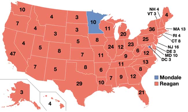
1984: Ronald Reagan vs. Walter Mondale
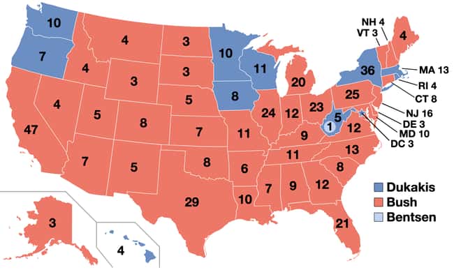
1988: George H. W. Bush vs. Michael Dukakis
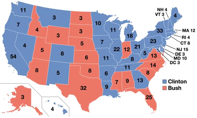
1992: Bill Clinton vs. George H. W. Bush
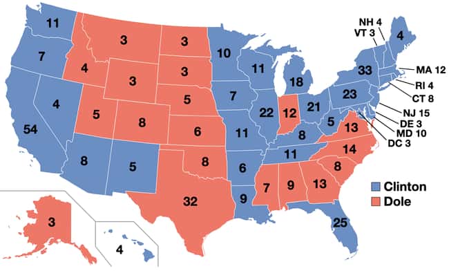
1996: Bill Clinton vs. Bob Dole
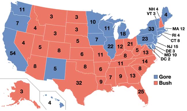
2000: George W. Bush vs. Al Gore
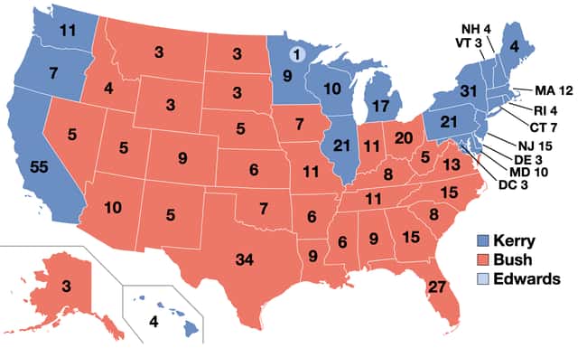
2004: George W. Bush vs. John Kerry
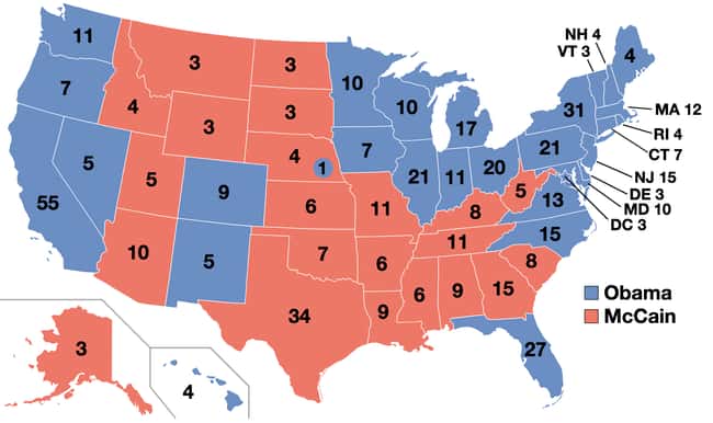
2008: Barack Obama vs. John McCain
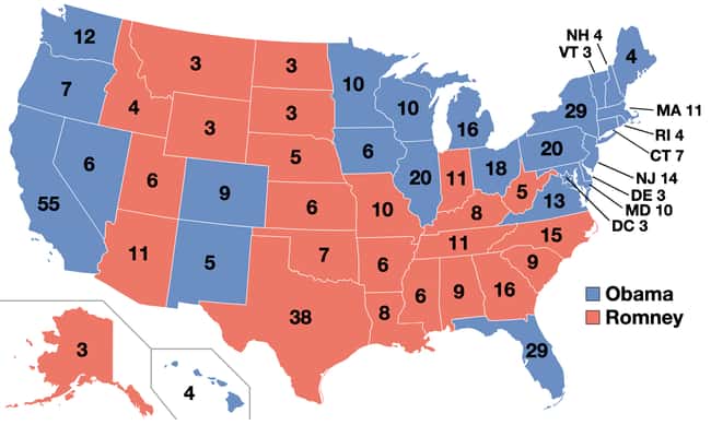
2012: Barack Obama vs. Mitt Romney
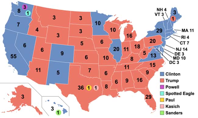
2016: Donald Trump vs. Hillary Clinton