More On: Google Maps
Google Maps might have caught a plane that crashed in the Australian rainforest
Google Maps commuting feature can warn about crowded subways
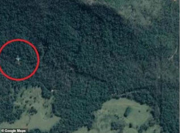
Google Maps seems to have caught a crashed plane in a rainforest in Australia, but did it?
A user with a sharp eye saw what looked like a whole plane in a clearing in the Cardwell Range, which is about 155 miles south of Port Douglas on the Queensland coast.
The picture could also show the plane, which the Daily Mail says looks like a standard Airbus A320 or Boeing 737, flying very low and making it look like it is on the ground.

But Australian officials in charge of safety said it's probably just a bug in Google's satellite software.
Australia's Civil Aviation Safety Authority told the Cairns Post, "There seems to be a thing called ghost images, and that could be what this is."
The Australian Transport Safety Bureau also said that it didn't know of any passenger jets that had gone missing.
In 2016, when a downed plane that never actually crashed was seen at the bottom of a Minneapolis lake on Google Maps, a Google spokesperson said that satellite images on the website are made up of several images.
"Objects that move quickly, like planes, usually only show up in one of the many pictures we use for a certain area. "When this happens, it's sometimes possible to see faint traces of the fast-moving object," Susan Cadrecha said.
Google hasn't said for sure that this is true in Queensland yet.


